Station source
NJ TRANSIT maintains Berkeley Heights Station line, advisory, ticketing, bicycle, and parking information.
Union County · Official-source local guide
An official-source guide to Berkeley Heights Station, district campuses, Snyder Avenue Park, zoning and tree review, flood maps, wetlands, and block-and-lot research.
Last reviewed August 25, 2026 · Verify time-sensitive details with the linked official publisher.
The township's existing-conditions plan describes Berkeley Heights as a Union County municipality with a mayor-and-council form and local departments at Town Hall. Planning documents provide useful context, but parcel decisions still belong in current zoning, engineering, assessment, and permit records.
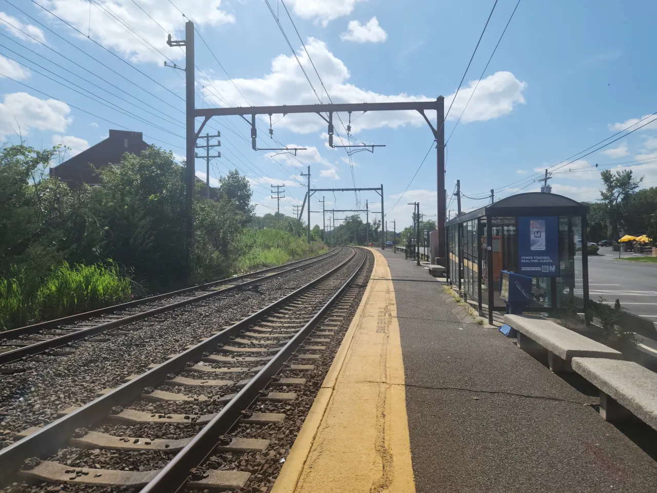
Berkeley Heights Station is on NJ TRANSIT's Morris & Essex system near Sherman and Plainfield avenues. The township also includes county-managed recreation land. Snyder Avenue Park, for example, is identified as county-owned while the local Recreation Commission and Public Works Department have stated maintenance roles. Agency boundaries matter when verifying a rule or facility.
NJ TRANSIT maintains Berkeley Heights Station line, advisory, ticketing, bicycle, and parking information.
Berkeley Heights Public Schools lists local PreK–8 campuses and Governor Livingston High School, including its Mountainside sending relationship.
The township facility page identifies Snyder Avenue Park as county-owned and explains local maintenance responsibilities.
Township offices separately handle zoning, tree permits, flood maps, wetlands maps, block and lot, building permits, and development questions.
Use the official department directory to route each parcel question instead of expecting one page or person to answer everything.
Township existing-conditions plan
Government, land-use, conservation, and transportation context
Berkeley Heights Station
Morris & Essex system station and parking information
Berkeley Heights Public Schools
District campuses and high-school sending relationship
Responsible Department
Zoning, flood, wetlands, block-and-lot, and permit contacts
Berkeley Heights Public Schools lists Mary Kay McMillin, William Woodruff, Thomas P. Hughes, Mountain Park, Columbia Middle School, and Governor Livingston High School. The district also states that students from Mountainside join Berkeley Heights students at Governor Livingston for high school. That regional relationship is a fact to understand when reviewing district records.
Use the district for current assignment, registration, transportation, boundaries, board records, and program details. Then use NJDOE School Performance Reports for state-published measures with the report year and definitions in view. Neither source supports turning a school or district into a one-word real-estate claim.
Open the official district source → Search NJDOE School Performance Reports →
NJ TRANSIT places Berkeley Heights Station near Sherman Avenue and Plainfield Avenue on the Morris & Essex system. The station page identifies municipal and NJ TRANSIT parking areas and publishes current advisories. Operator, permit, accessibility, and ticketing details should be rechecked for the intended date.
The useful comparison begins at the target driveway. Account for the route to the station, a verified parking or drop-off plan, the current schedule, and the destination-side connection. Repeat the check for any secondary travel pattern rather than assigning one fixed commute description to the entire township.
Review the current Berkeley Heights Station record and linked alerts before relying on saved parking or service information.
NJ TRANSIT identifies both municipal and agency-owned parking. Confirm the rule for the actual lot and intended user.
Use the exact property route and current township information; municipality-wide distance language does not establish daily access.
The township's Snyder Avenue Park facility page lists field sports, a playground with spray area, and other facility details. It also states that Union County owns the park, while local recreation and public works participate in maintenance. Check current rules, field status, and reservations with the responsible agency before relying on an amenity.
Berkeley Heights' official planning material also identifies a broader mix of municipal and county open space. Boundaries, trail conditions, and allowed uses are property- and facility-specific. Use the township and county records for the named location rather than assuming a nearby wooded parcel is public or accessible.
The township routes these subjects to different offices. Start with a survey and block-and-lot identity, then ask each responsible office the narrow question it maintains.
Use the current map and regulations for setbacks, building coverage, other coverage, structures, additions, pools, patios, decks, walls, and fences.
The Zoning and Tree Inspections office publishes current permit rules. Verify whether a proposed removal or right-of-way tree requires approval.
The township directory routes flood-map questions to Engineering and identifies wetlands-map responsibility. Review both when site conditions warrant.
Confirm the tax parcel, assessment record, survey, easements, open permits, and any planning or zoning-board resolution before designing work.
Verification note: Confirm current taxes, assessment, zoning, permits, flood or wetlands status, transit, and school assignment with the official agency and qualified professionals. This guide is informational and is not legal, tax, engineering, insurance, inspection, or school-placement advice.
Keep the source date and parcel identifier beside every material fact so the transaction team can recheck it before a deadline.
Create separate entries for zoning, engineering, tree, building, tax, school, transit, and park issues and contact the office listed by the Township.
Match the survey to zoning, coverage, easements, slopes, drainage, flood and wetlands information, and the intended work before pricing a project.
Verify station parking ownership, county versus township park responsibility, and the district's school arrangement for the address.
Buyers can retain source dates and professional findings; sellers can assemble approvals, permits, survey, assessment, repair records, and disclosures.
NJ TRANSIT lists Berkeley Heights Station on the Morris & Essex system. Check the official station page and current schedule for service, parking, and alerts.
Berkeley Heights Public Schools lists the local campuses and states that Mountainside students join Berkeley Heights students at Governor Livingston High School. Confirm address details directly with the district.
The Township facility page identifies Snyder Avenue Park as owned by Union County and describes local recreation and public-works maintenance roles. Confirm current use rules with the responsible agency.
The Zoning and Tree Inspections office publishes permit requirements for qualifying trees and right-of-way trees. Ask the office to apply the current ordinance to the specific tree and project.
The Township Responsible Department directory routes flood-map and wetlands-map questions to the appropriate engineering or zoning contacts. Use the exact block, lot, and survey.
Jorge Ramirez can help organize a current listing or sale analysis while municipal, district, transit, and professional sources answer the questions they control.
No-obligation conversation · Verify all property facts before acting
Accessed August 25, 2026. Links may publish newer information after this review, so open the source again when making a decision.
Prepared by Jorge Ramirez · Licensed New Jersey Real Estate Agent #1754604 · Keller Williams Premier Properties.
Continue local research
Move from public records to current property evidence, then choose the buyer, seller, or valuation path that matches the address and your next decision.