Public decisions
Use Township Committee agendas and minutes to see adopted action, then confirm how an ordinance applies with the responsible office.
Union County · Official-source local guide
A source-backed starting point for checking a Cranford address, from the Raritan Valley Line and public-school records to zoning and floodplain research.
Last reviewed August 25, 2026 · Verify time-sensitive details with the linked official publisher.
Cranford is governed by a five-member Township Committee, which appoints the mayor and deputy mayor each year. The official committee page is the direct place to review public agendas, approved minutes, appointments, and links to current municipal action instead of relying on a summary that can become stale.
For a housing decision, the town-wide description matters less than the exact lot. Cranford publishes an interactive zoning map, land-development materials, and separate flood resources. Because the Township specifically asks prospective buyers and owners to understand possible flood exposure, a parcel review should include both municipal mapping and the current federal flood map before an offer or renovation plan is finalized.
Use Township Committee agendas and minutes to see adopted action, then confirm how an ordinance applies with the responsible office.
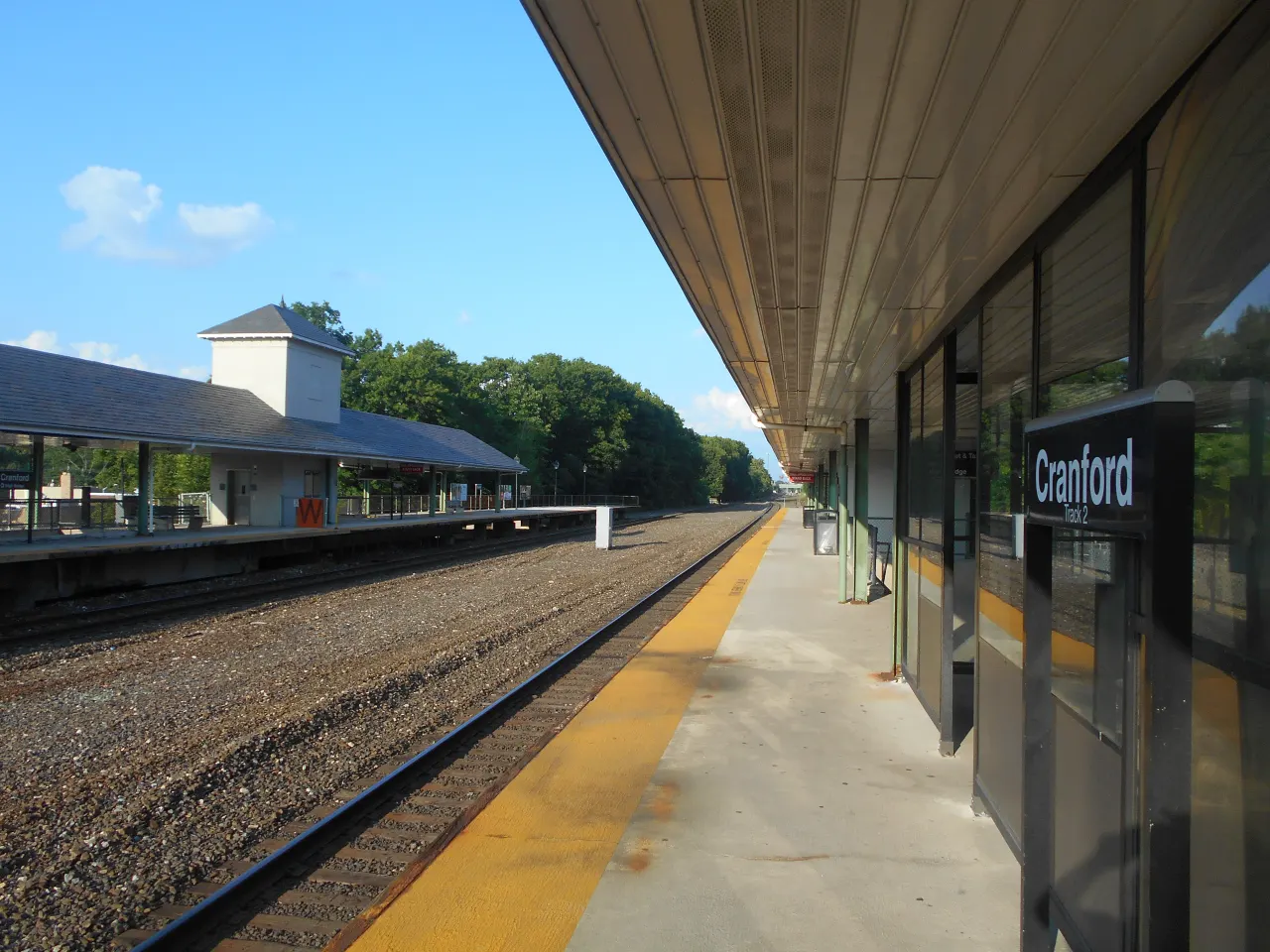
Cranford Station is on NJ TRANSIT's Raritan Valley Line. Use the station page for current advisories, ticketing, bicycle, and parking information.
Check the Township flood-map page and current FEMA material by address. A neighborhood label is not a substitute for parcel research.
Union County's directory identifies Nomahegan, Sperry, and Unami among the public park resources associated with Cranford.
Use the agency responsible for each decision. These links lead to the live public record, not a score or sales pitch.
Township Committee
Five commissioners; current agendas and approved minutes
Cranford Station
Raritan Valley Line station details and alerts
Cranford Public Schools
District directory, registration, reports, and notices
Township maps
Zoning, applications, and parcel-level flood resources
Cranford Public Schools maintains the current district directory, registration materials, calendars, and reports. Its school list includes multiple elementary configurations, two K–8 campuses, and Cranford High School. Buyers should verify the assigned school for a specific address with the district; proximity to a building does not establish assignment.
For comparable public data, search the New Jersey Department of Education School Performance Reports by district or individual school. NJDOE presents these reports as a starting point for learning and conversation. Review the underlying measures and year, then add district documents, board materials, programs, transportation rules, and a direct district conversation to the decision.
Open the official district source → Search NJDOE School Performance Reports →
NJ TRANSIT identifies Cranford Station on the Raritan Valley Line. The station page is the reliable place for the service line, live advisories, ticketing, bicycle facilities, and parking notices. Timetables, transfer patterns, track work, and parking arrangements can change, so this guide does not publish a promised travel duration.
Test a trip from the property, not just from the station pin. Include the walk or drive to the station, parking eligibility, departure needed for the actual work schedule, transfer requirements, and the final leg at the destination. Re-run that check for evenings and weekends if those trips matter to the household.
Open NJ TRANSIT's Cranford Station page and then the current schedule and alert tools before comparing properties.
Confirm permit rules and availability with the operator named by NJ TRANSIT; third-party parking details can change without notice.
A normal-day route does not answer flood or storm access questions. Review official emergency and flood information for the specific address.
Union County's parks directory is useful for confirming which facilities are county-managed and what activities are listed at each location. It includes Cranford entries such as Nomahegan Park, Sperry Park, and Unami Park. Verify reservation rules, closures, and facility status on the county site before treating an amenity as available for a particular use.
For downtown or redevelopment questions, use Cranford's planning and zoning resources and adopted-ordinance archive. Public plans can explain intended land-use policy, but they are not a guarantee that a proposed project will proceed. Confirm adopted approvals and current status with the Township when a nearby proposal affects a buying or selling decision.
Ask for documents tied to the block, lot, structure, and intended use. Verify every time-sensitive item with its official source.
Review the current FIRM and Township flood information, then inspect grading, drainage, water entry history, insurance requirements, and permits with qualified professionals.
Confirm the zoning district, overlays, setbacks, prior approvals, open permits, and whether a planned addition or accessory use is allowed.
Obtain the current municipal tax record and assessment for the exact parcel. Do not estimate a future bill from a neighboring home or listing field.
Verify assignment and registration requirements directly with Cranford Public Schools before relying on a portal, map pin, or prior owner's information.
Verification note: Confirm current taxes, assessment, zoning, permits, flood or wetlands status, transit, and school assignment with the official agency and qualified professionals. This guide is informational and is not legal, tax, engineering, insurance, inspection, or school-placement advice.
Keep the source date and parcel identifier beside every material fact so the transaction team can recheck it before a deadline.
Record the block and lot, intended use, financing needs, station routine, and any renovation plan before comparing addresses.
Open zoning, flood, tax, permit, school, and transit sources for that address; save dated copies of anything central to the decision.
Use an attorney, inspector, lender, insurance professional, surveyor, or municipal office as the issue requires; a real-estate guide cannot replace them.
For a purchase, compare the verified property condition and restrictions with current listing and closed-sale data. For a sale, disclose known material facts and document improvements.
Yes. NJ TRANSIT lists Cranford Station on the Raritan Valley Line. Check the official station, schedule, and alerts for the trip date rather than relying on an estimated travel time.
Start with Cranford's official flood-map page and current federal mapping, then verify the exact parcel, elevation, insurance, drainage, and building history with the appropriate professionals and Township offices.
Use Cranford Public Schools for current schools, assignment, registration, calendars, and district records, and use NJDOE School Performance Reports for state-published data. Verify assignment for the property directly with the district.
No. A map identifies a starting district, but an official parcel review must account for overlays, lot conditions, prior approvals, current ordinances, and the exact scope of work.
Useful records include the current tax card, survey, permits and approvals, improvement invoices, known flood or water information, utility and system details, and disclosures reviewed with the appropriate professionals.
Jorge Ramirez can help organize a current listing or sale analysis while municipal, district, transit, and professional sources answer the questions they control.
No-obligation conversation · Verify all property facts before acting
Accessed August 25, 2026. Links may publish newer information after this review, so open the source again when making a decision.
Prepared by Jorge Ramirez · Licensed New Jersey Real Estate Agent #1754604 · Keller Williams Premier Properties.
Continue local research
Move from public records to current property evidence, then choose the buyer, seller, or valuation path that matches the address and your next decision.